|
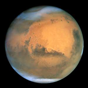
Eighth grade students in Mr. McCollum's science classes
modeled the laser mapping of the Martian surface done by an
instrument on Mars Global Surveyor called MOLA ( Mars
Orbital Laser Altimeter ). They created sections of
simulated Martian terrain in empty shoe boxes using rocks,
Styrofoam cups, cardboard, and masking tape. They then
sealed the boxes and traded with those constructed by other
students. Using a grid system of coordinates and metal rods
calibrated in 1 cm units, they probed the boxes and were
able to determine the topography of the hidden terrain. They
then entered their MOLA data into the computer software
program - NIH Image to render full color image maps and 3-D
surface plots of the model terrain in each box. (
Lesson instructions )
|