|
Tools of the Atmospheric Scientist Lesson #7 - Measuring Wind Profiles |
|
|
|
Target Level - Middle School/Junior High
|
Wind is air in motion relative to the surface of the Earth. It is the result of the natural flow of air from a region of higher pressure to a region of lower pressure. Its speed and direction are governed by a combination of many factors including the proximity of high and low pressure centers, friction with the surface, altitude, the rotation of the Earth, and the uneven heating of the Earth by the sun (Fig. 1). We live under an ocean of air, and wind represents its currents. It can cool us with a refreshing summer breeze, or unleash some of nature's most destructive forces - tornadoes and hurricanes. |

(Credit - NOAA) |
 (Credit - NOAA) |
The primary instrument used by meteorologists to measure wind speed is the anemometer. A wind vane can be added to determine wind direction (Fig. 2). However, measurements of the wind by these instruments are limited to the height at which they are mounted. Because wind speed and direction can change with altitude, a different instrument is needed to monitor upper level air flow and direction. Such measurements help us better understand the dynamics of our ever-changing atmosphere and aid in forecasting the weather. |
|
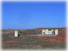
Arm scientists use a device called the Radar Wind Profiler to gain a vertical "picture" of horizontal wind speed and direction to a height of 12 kilometers. It operates by transmitting electromagnetic energy and an acoustic signal into the atmosphere and recording the strength and frequency of reflected signals back to the surface (Fig. 3).
|
(Credit - ARM) |
 (Credit - ARM) Click on picture for larger view |
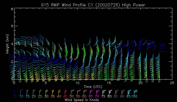
Sample data from the Radar Wind Profiler can be seen in Fig. 4. The left vertical axis represents the range height in kilometers. The time scale at the bottom of the graph is shown in Universal Coordinated Time (UTC), which is six hours ahead of SGP local time during standard time and five hours ahead during daylight savings time. The wind speed and wind direction at various heights are designated by the wind barbs. The wind speed can be determined by both the color code and by the number of lines or pennants attached to the shaft of each barb. Each barb also points to the direction from which the wind is blowing at that particular height. A barb pointing up denotes a north wind, to the right an east wind, down a south wind, and to the left a west wind.
|
|
Activity - Measuring Wind Profiles |
|
1. Go to the ARM SGP RWP site and select a date from the current or previous month. 2. Data plots are displayed for both high power and lower power. How do they differ? 3. Use the left vertical scale to estimate the maximum height of wind speed and direction detected by the instrument. 4. What was the wind speed at that height? What was the wind direction at that height? |
|
Interpreting the Data |
|
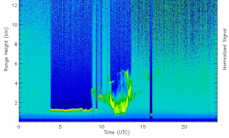
1. Go to the ARM SGP MMCR site and select a date on which strong reflective signals can see seen in the data plots. 2. Now go to the ARM SGP RWP site and select the same date. 3. The passing of a front can often trigger storms, an increase in upper level wind speeds, and a change in wind direction. Can you find evidence of this in the RWP data plot? Congratulations! You have taken another step in understanding how meteorologists use atmospheric data to help monitor and forecast the weather. |
|
National Science Education Standards Annotated by MCREL (Standard -
Level - Benchmark) |
|
Standard 1. Understands atmospheric processes and the water cycle: 1-III-1, 1-III-2, 1-III-4, 1-III-6 Standard 9. Understands the sources and properties of energy: 9-III-8, 9-III-9 Standard 10. Understands forces and motion. 10-III-3, 10-III-4, Standard 11. Understands the nature of scientific knowledge: 11-III-2 Standard 12. Understands the nature of scientific inquiry: 12-III-1, 12-III-5, 12-III-6, 12-III-7 Standard 13. Understands the scientific enterprise: 13-III-3 |
Return to Tools of the Atmospheric Scientist