|
Using Visualization
Tools to The ARM Project |
|
|
|
|
|
|
|
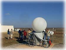
Balloon-Borne Sounding System (BBSS) These weather balloons are released from the ARM sites. As they ascend they measure and transmit air pressure, temperature, relative humidity, and can help determine wind speed and wind direction. From this information scientists can also derive dew point, latitude and longitude of the balloon, and other components of wind. |
|
|
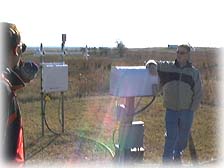
Surface Meteorological Observation System (SMOS) This system uses conventional weather instruments to make surface measurements of wind speed, wind direction, air temperature, relative humidity, barometric pressure, and precipitation. Snow depth can also be measured at the SMOS. |
|
|
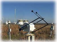
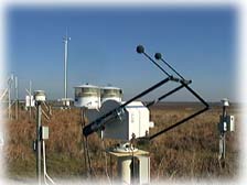
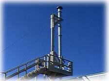
Radiometers Radiometers measure radiant energy. The type of radiometer shown is from the Solar Infrared Radiation Station (SIRS) and is used to measure both solar and atmospheric radiation. The radiation can be coming from above (downwelling) or upward from the surface (upwelling). |
|
|
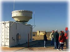
Millimeter Wave Cloud Radar (MMCR) The MMCR transmits a radar pulse directly overhead to determine the tops and bottoms of clouds. It can also serve as a type of Doppler radar in measuring up and down particle movements within a cloud. |
|
|
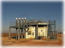
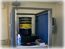
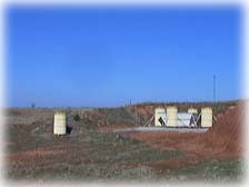
Radiometric Calibration Facility (RCF) The value of any scientific data is dependent upon the accuracy of the instrument through which it was measured. The RCF is used for accurate calibration of radiometers.
|
|
|
Microwave Water Radiometer (MWR) This instrument is a microwave receiver that measures columns of water vapor and liquid water in the air. |
|
|
Micropulse Lidar (MPL) This instrument uses lidar (light detection and ranging) which is similar to radar. A pulse of energy is transmitted and reflected back. The measured time delay between the original pulse and the reflection is used to determine cloud altitude. |
|
|
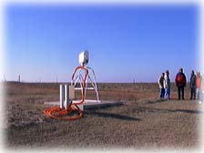
Radar Wind Profiler (RWP) This instrument measures wind profiles ( cross-sections ) up to 5 km and temperature profiles up to 1.5 km. It does this by transmitting both electromagnetic signals and sound waves into the air. |
|
|
The Aerosol Observing System (AOS) This instrument makes surface measurements of aerosols which are tiny solid or liquid particles suspended in the air. Some examples would be smoke, dust, or fog. Scientists hope to use this data to better understand how these particles may interact with solar radiation and influence the earth's radiation balance and climate system. |
|
|
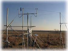
Energy Balance Bowen Ratio (EBBR) This is a system of senors which monitor the exchange of heat between the ground and the air above it. |
|
|
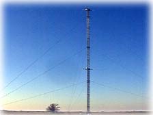
60 Meter Tower Temperature and relative humidity sensors are located at 25 meters and 60 meters on this tower to supplement other surface measurements. |
|
Return to CMS Meteorology Page