 |
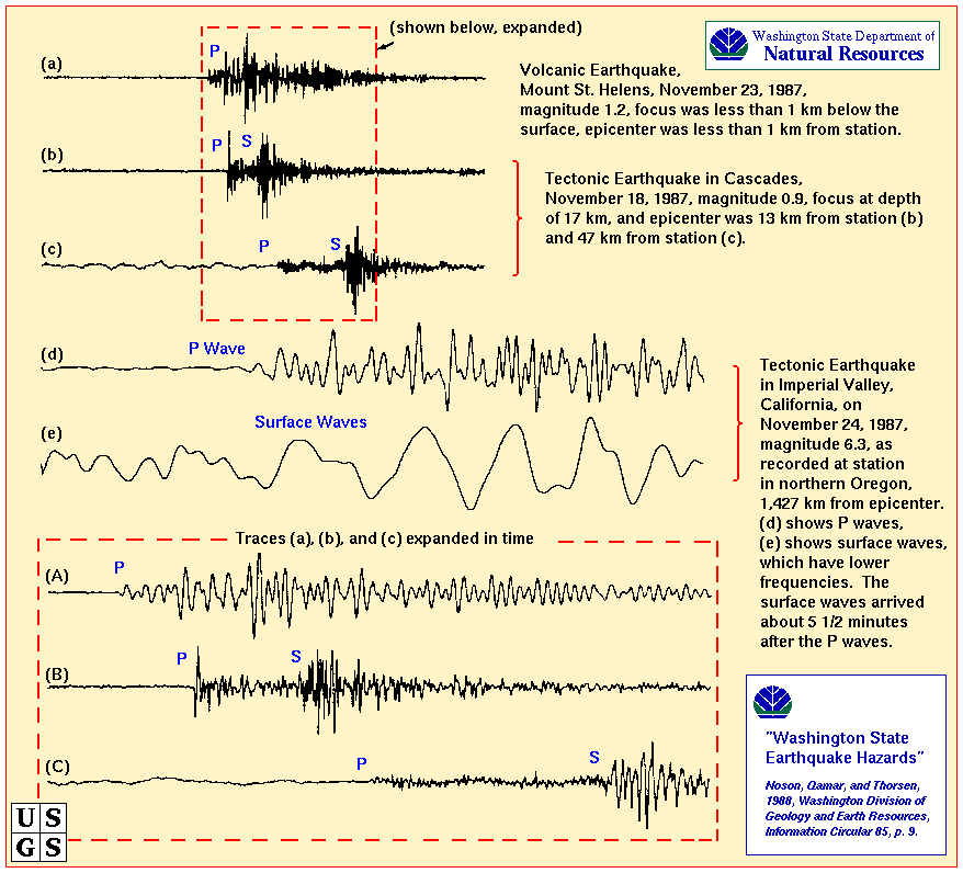
In class, I asked what indicators might be
used to predict
an eruption from one of the Cascade volcanoes. One criteria would be a
particular type of earthquake that is characteristic of magma moving
under
a volcano. This figure, from the Washington State Department of Natural
Resources, shows what harmonic tremors look like when compared to
typical
earthquakes. |
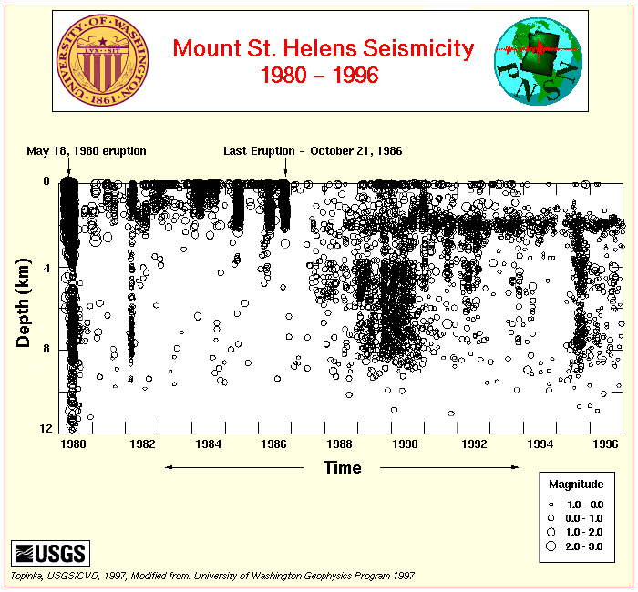 |
This image, provided by the University of
Washington
for the US Geological Survey, shows the depth and amount of seismic
activity
that occurred beneath Mount St. Helens from 1980 through 1996. During
1980
there is clear seismic activity indicating magma movement from 12
kilometers
depth all the way up to the surface. Between 1988 and 1991, there is
relatively
well constrained activity from 9 to 4 kilometers depth and at
approximately
2 kilometers depth. These depth ranges and seismic activity may
indicate
that the magma chamber and its conduit, or plumbing system, for Mount
St.
Helens lies at that depth. |
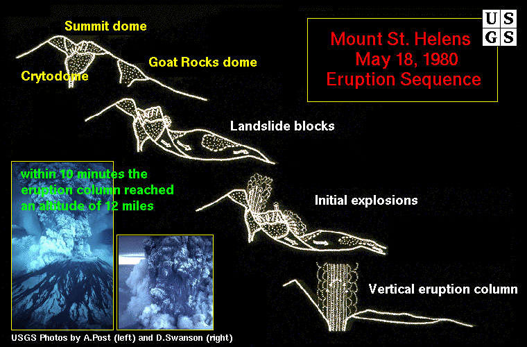 |
As explained in class, the eruption of Mount
St. Helens
wasn't the typical central vent type eruption. As the magma chamber
below
Mount St. Helens was slowly filled, it inflated the mountain and caused
a bulge in the flanks of the mountain. Being slightly off-centered also
contributed to the devastation of the eruption. Just before the
eruption,
a small earthquake triggered a landslide centered on the bulge (over
the
magma chamber), which allowed the chamber to be exposed. This series of
figures from the US Geological Survey, shows the events that happened
during
and after the landslide. Since the bulge and landslide were on the
northern
face of the mountain, the ensuing directed blast was focused in that
direction
as well. |
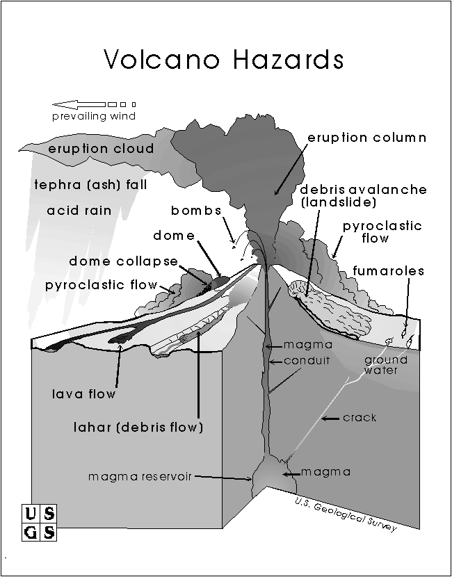 |
The volcanic hazards associated with any
eruption aren't
just the erupting lava and ash as most people might think. Ash ejected
high into the atmosphere can effect temperatures, acidity of rain, as
well
as the total amount of sunlight reaching the ground. Pyroclastic flows
from an eruption may travel hundreds of kilometers from the eruption at
hundreds of kilometers per hour to devastate regions that aren't
thought
to be in danger. Even a relatively quiet volcano can have unseen
dangers
in the form of fumaroles that vent toxic gases such as carbon dioxide,
an odorless, colorless gas that is heavier than air and which will
settle
in depressions forming death zones, or hydrogen sulfide - that rotten
egg-smelling
gas. |
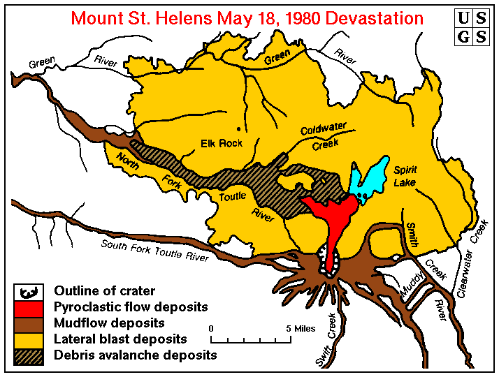 |
As seen in this post-eruption devastation map
from the
US Geological Survey, most of the destruction was focused north of
Mount
St. Helens. Pyroclastic deposits (ash-flows, pumice flows, etc.) were a
minor constituent of the total devastation. The associated mudflows
caused
more damage. |
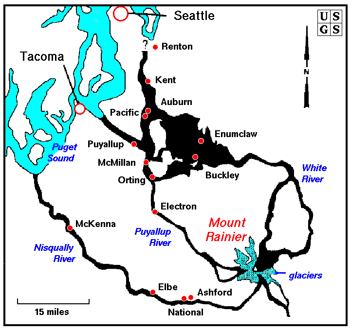 |
Other volcanoes in the Cascade Range aren't
free of the
hazards that were seen at Mount St. Helens. This map from the US
Geological
Survey, shows the mudflows that have been identified in the last few
years
as having come from Mount Rainier. Notice that some towns, the red
dots,
are built right in the path of possibly future mudflows. Even the
suburbs
of Seattle and Tacoma are built on mudflows and debris flows of Mount
Rainier.
With all of Mount Rainier's glaciers, a future eruption, even if small,
could have devastating effects many miles downstream. |
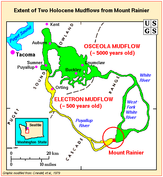 |
As recently as 500 years ago, the Puyallup
River was
the site of devastating mudflows that roared down it's drainage and
covered
the future sites of Electron and Orting. The older Osceola Mudflow,
~5000
years old, was even more extensive. It flowed north from Mount Rainier
along the West Fork of the White River and the White River drainages
then
headed west. As soon as it left the confines of the drainage in the
Cascades
and entered the Puget Sound Lowlands, it spread laterally. A similar
flow
today would cover towns almost all the way to Puget Sound. |
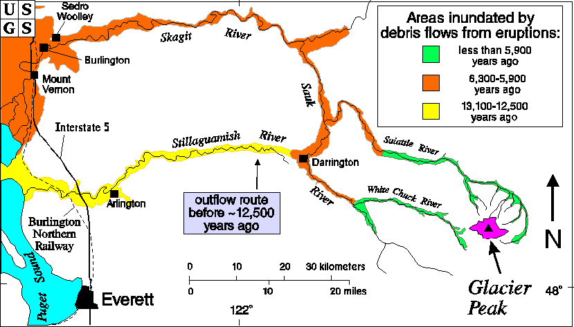 |
To the north of Mount Rainier, Glacier Peak
posses just
as much a hazard. Mudflows from it reached all the way to the northern
part of Puget Sound and covered what became the towns of Arlington and
Mount Vernon. |
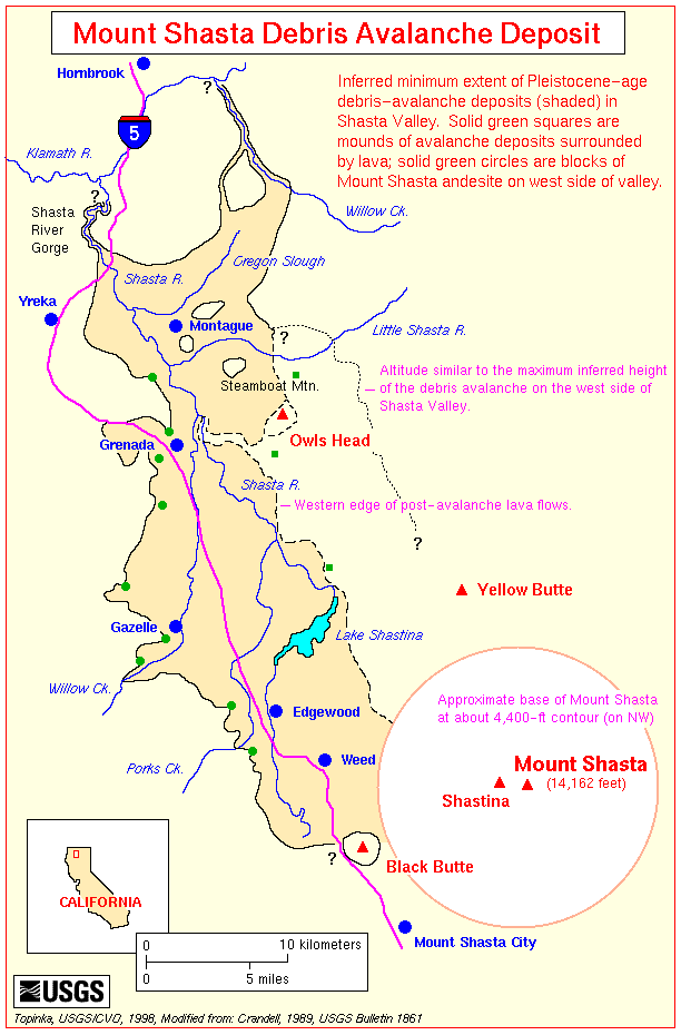 |
Although not in an as populated region as
Mount Rainier
and Glacier Peak, Mount Shasta has had serious mudflows and debris
flows.
The area north from Shasta along Interstate 5 almost up to Hornbrook
was
covered by a large landslide and avalanche. If you have driven along
I-5
into California, you may have noticed the flats areas between the
hummocky
hills north of Mount Shasta - you were driving through an old,
~Pleistocene-aged,
landslide deposit! |
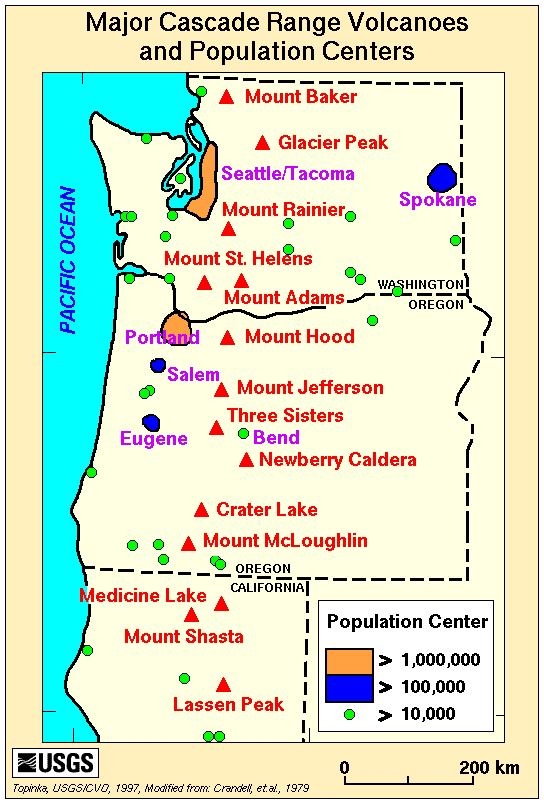 |
This last figure, a location map showing the
major volcanic
peaks in the Cascades and their relationship to population centers,
should
make you ask the question - what are the future hazards from volcanoes
in the Cascades? |