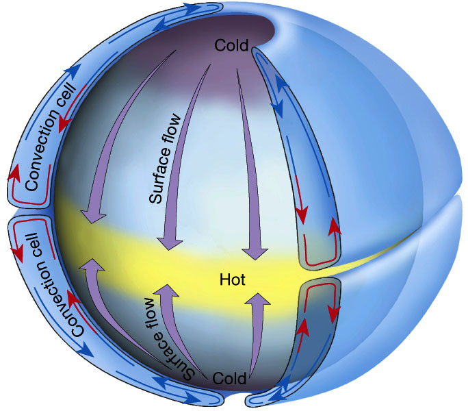
Simple, single cell atmospheric convection in a
non-rotating
Earth. "Single cell" being either a single cell north or south of
the equator.
Figure 7.5 in The Atmosphere, 8th edition, Lutgens and Tarbuck,
8th edition, 2001.
Microscale
Macroscale Circulation
To begin, imagine the earth as a non-rotating sphere
with
uniform smooth surface characteristics.
Assume that the sun heats the equatorial regions much
more than the polar regions.
In response to this, two huge convection cells develop.
Simple, single cell atmospheric convection in a
non-rotating
Earth. "Single cell" being either a single cell north or south of
the equator.
Figure 7.5 in The Atmosphere, 8th edition, Lutgens and Tarbuck,
8th edition, 2001.
An intermediate model: We now allow the earth to rotate. As expected, air traveling southward from the north pole will be deflected to the right. Air traveling northward from the south pole will be deflected to the left.
However, by looking at the actual winds, even after averaging them over a long period of time, we find that we do not observe this type of motion. In the 1920ís a new conceptual model was devised that had three cells instead of the single Hadley cell. These three cells better represent the typical wind flow around the globe.
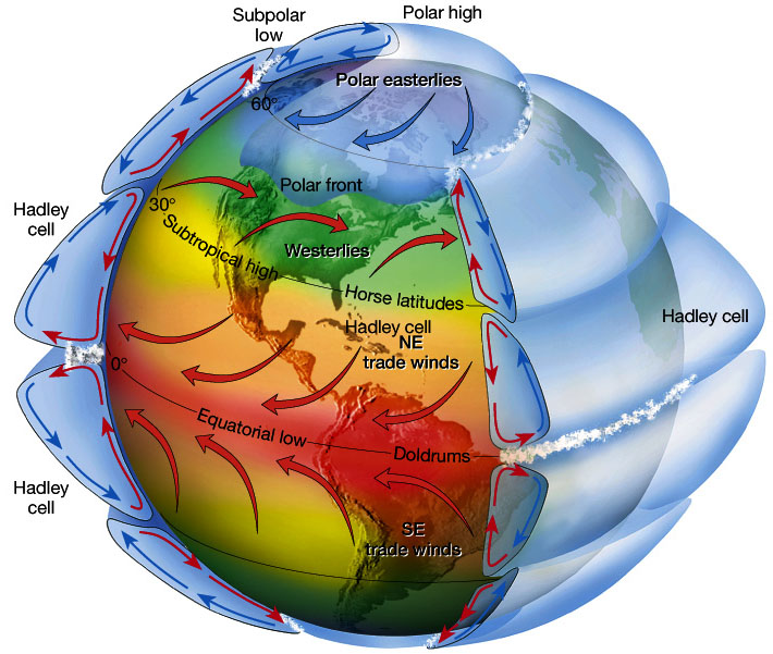
Idealized, three cell atmospheric convection in a
rotating
Earth. "Three cell" being either three cells north or south of
the
equator. The deflections of the winds within each cell is caused
by the Coriolis Force.
Figure 7.5 in The Atmosphere, 8th edition, Lutgens and Tarbuck,
8th edition, 2001.
Horse Latitudes
Around 30°N we see a region of subsiding (sinking)
air. Sinking air is typically dry and free of substantial
precipitation.
Many of the major desert regions of the northern
hemisphere
are found near 30° latitude. E.g., Sahara, Middle East, SW
United
States.
Doldrums
Located near the equator, the doldrums are where the
trade winds meet and where the pressure gradient decreases creating
very
little winds. That's why sailors find it difficult to cross the
equator
and why weather systems in the one hemisphere rarely cross into the
other
hemisphere. The doldrums are also called the intertropical
convergence
zone (ITCZ).
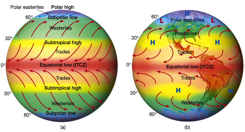
A) Idealized winds generated by pressure gradient and
Coriolis Force. B) Actual wind patterns owing to land mass
distribution..
Figure 7.7 in The Atmosphere, 8th edition, Lutgens and Tarbuck,
8th edition, 2001.
Owing to the tilt of the Earth's axis in orbit, the ITCZ will shift north and south. It will shift to the south in January and north in July.
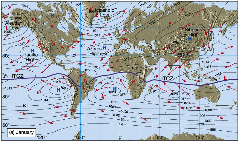
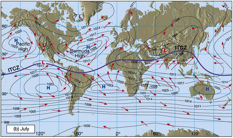
This shift in the wind directions owing to a northward or southward shift in the ITCZ results in the monsoons. Monsoons are wind systems that exhibit a pronounced seasonal reversal in direction. The best known monsoon is found in India and southeast Asia.
Jet Streams (revisited)
Remember, we have already talked about why the jet stream forms. well, jet streams will form at the approximate boundaries between the cells we've just discussed. So we should have a subtropical jet stream as well as a midlatitude jet stream.
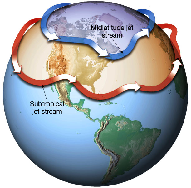
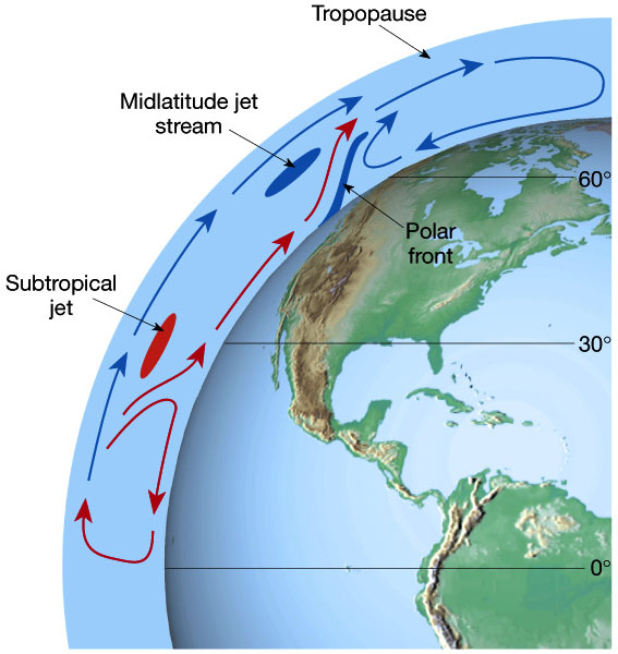
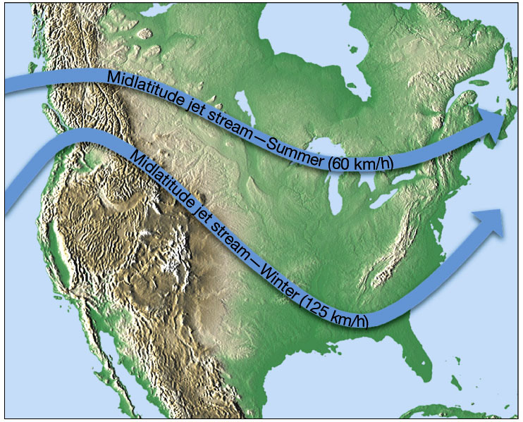
Since the locations of the midlatitude and subtropical
jet streams are close to the cell boundaries, the jets will migrate
with
the seasons, like the ITCZ.
Figure 7.15 in The Atmosphere, 8th edition, Lutgens and
Tarbuck,
8th edition, 2001.
Next time, we will talk of how oceanic circulation
works
with atmospheric circulation.